
Outdoor Adventures in the Quabbin Reservoir
Hiking and biking outdoor adventures in the Quabbin Reservoir will take you to remote areas that will take your breath away. This pristine body of water has a unique history and a wilderness feel seldom found on the East Coast. I will introduce you to my favorite places to hike and bike in the Quabbin.
Posts may contain links to products and services I love. I may make a small commission from them, at no extra cost to you. Thank you for supporting my blog.
History of the Quabbin Reservoir
The Quabbin Reservoir watershed tells its story through old foundations, cellar holes, stone walls, and country roads that now end at the water’s edge. This area once supported the bustling towns of Enfield, Dana, Prescott, and Greenwich in the Swift River Valley. But Boston’s growing need for water transformed these thriving villages forever. In 1938, the state disincorporated the four towns, forced residents to evacuate, and then destroyed the communities.
Workers built Winsor Dam and Goodnough Dike to block the Swift River and create one of the largest human-made public drinking water sources in the country. By 1939, water flowed in and gradually formed the massive 412-billion-gallon reservoir we see today.
Today, officials prioritize keeping the water pristine over recreational access. Strict rules limit what visitors can do in the Quabbin. Dogs aren’t allowed anywhere on the property. Visitors are also prohibited from swimming, drinking alcohol, lighting fires, flying drones, or engaging in cross-country skiing. However, the regulations do permit fishing, shoreline access, bicycling, and boating—but only in designated areas. People can use motorboats with fishing gear, but they cannot launch sailboats or paddle non-motorized craft, such as canoes and kayaks.
Accidental Wilderness
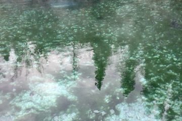
Ironically, these tight restrictions on recreation have turned the Quabbin into an “accidental wilderness.” When I’m standing along a Quabbin shore, I swear I’m on a lake in the Boundary Waters or the northern Maine woods. The protection of the water has created a huge remote tract of wilderness land.
Hiking Outdoor Adventures in the Quabbin Reservoir
Bear’s Den
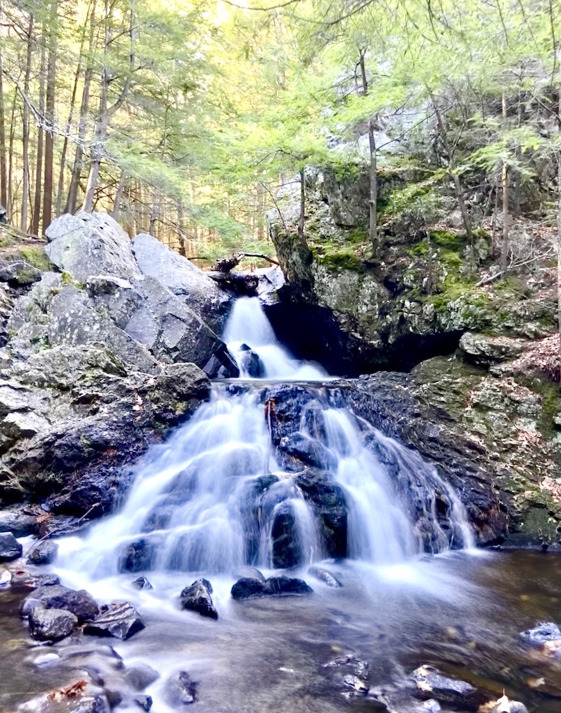
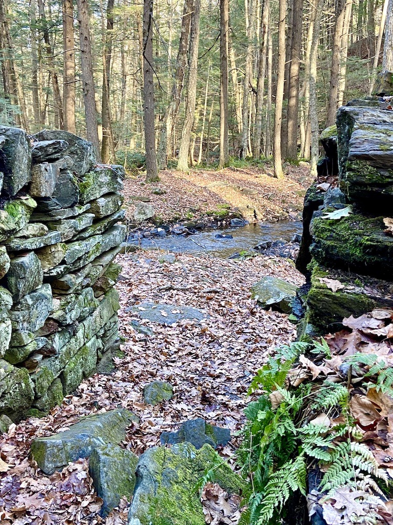
Bear’s Den is a tiny area of conserved land near New Salem. While the trail system is mini, the scenery is maxi. Waterfalls on the middle branch of the Swift River cascade through a gorge. Caves dot the cliffs. A historic mill’s rock wall remains can be seen on the half-mile loop trail. Unlike the lands of the Quabbin, Bear’s Den is dog-friendly. The trailhead is on Neilson Road in New Salem. This tiny pocket adventure would be great paired with another nearby hike.
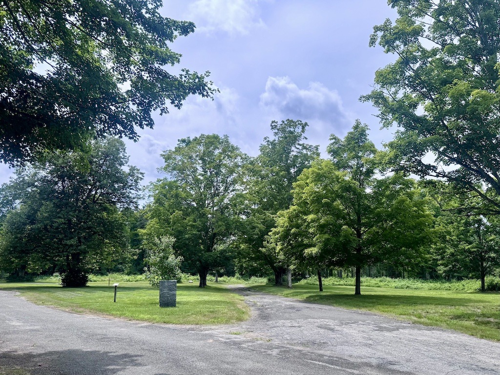
Quabbin Overlook – Gate 22 Outdoor Adventures in the Quabbin

Quabbin Overlook is a perfect pair to a visit to Bear’s Den. Drive over to the quaint, picturesque town of New Salem. The Quabbin Overlook trail starts behind the Fire Station. To find the trailhead, drive behind the fire station, pass the tennis courts, and continue until you reach a yellow gate where you will park. The loop trail quickly brings you to a jaw-dropping lookout over the Quabbin valley.
There are benches on the overlook to contemplate the immense scenic beauty stretching out before you.
Quabbin Gate 11 and 12 Outdoor Adventures in the Quabbin
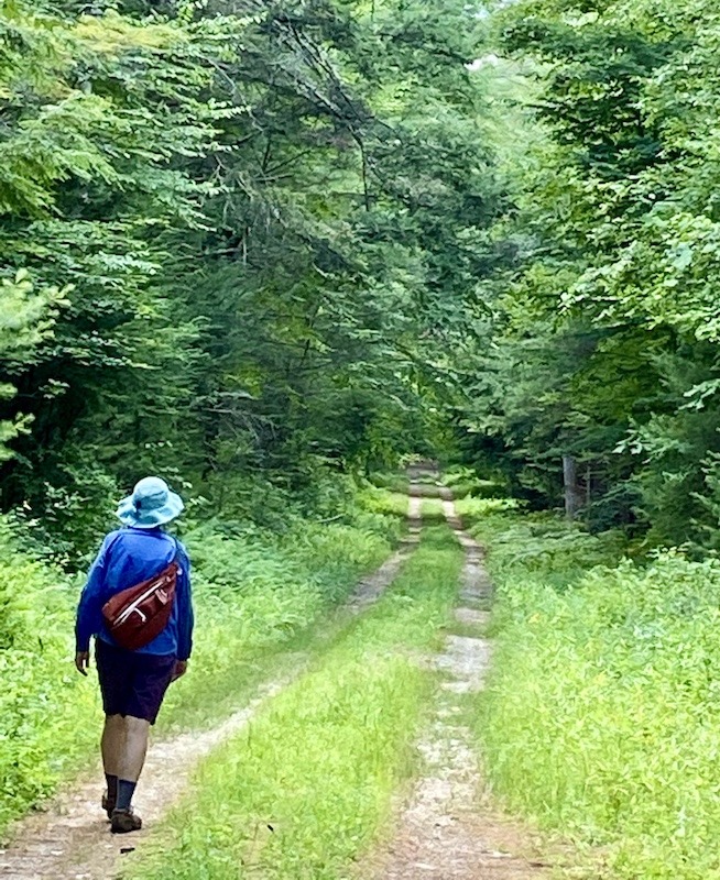
One of my favorite hikes is the Gate 11 to Gate 12 hike on the west side of the reservoir near Pelham. This section of the Quabbin explores remains of Prescott, one of the former towns displaced by the reservoir.
The Gate 11 to Gate 12 hike is a 6-mile loop that requires a few logistics, but is well worth it. If you have 2 cars, drop one at the Gate 12 parking lot and start your hike at Gate 11. The Gate 11 parking lot is directly across Route 202 from Amherst/Pelham Road. You can also run or bike the half-mile between the gates on Route 202.
Starting at Gate 11, walk slightly downhill through a mixed hardwood forest. In the old town of Prescott, stone foundations line the trail and reveal its history. These cellar holes are all that remain of the ghost towns of the Quabbin.
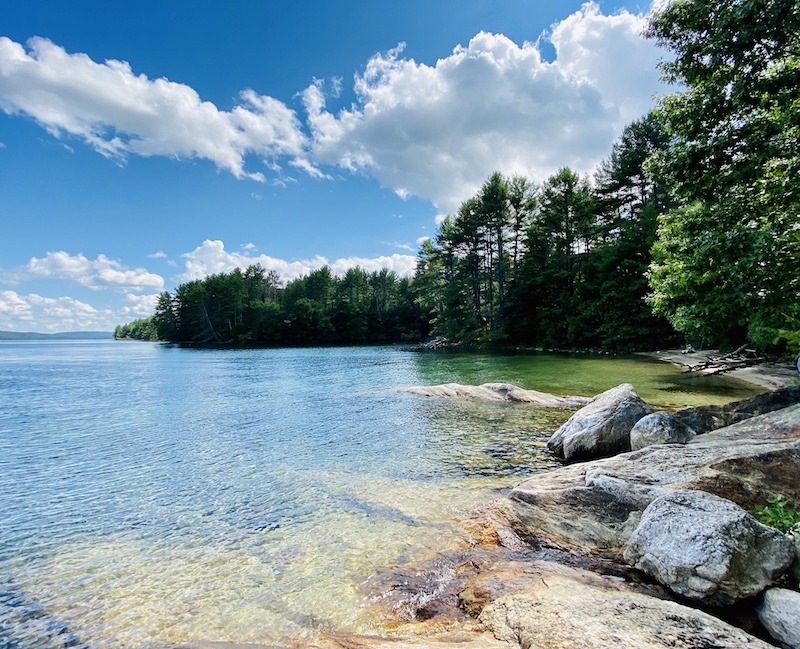
The hike continues down the two-track trail until you see the water through the trees. Don’t be tempted by the side trails, but continue on the old road around to the left and up a hill. The trail down to the water forks off to the right, past a portapotty, to a cobbled beach. Here, the astounding beauty of the lake is the highlight of this hike.
To complete the loop, backtrack to the main trail and continue north along Purgee Brook. Look for moose signs or actual moose in this area. I’ve seen both. The slightly uphill trail will take you back to Gate 12 on Route 202. An out-and-back hike from just Gate 11 is wonderful too, if you don’t want to do the shuttle.
Quabbin Gate 16 Outdoor Adventures in the Quabbin

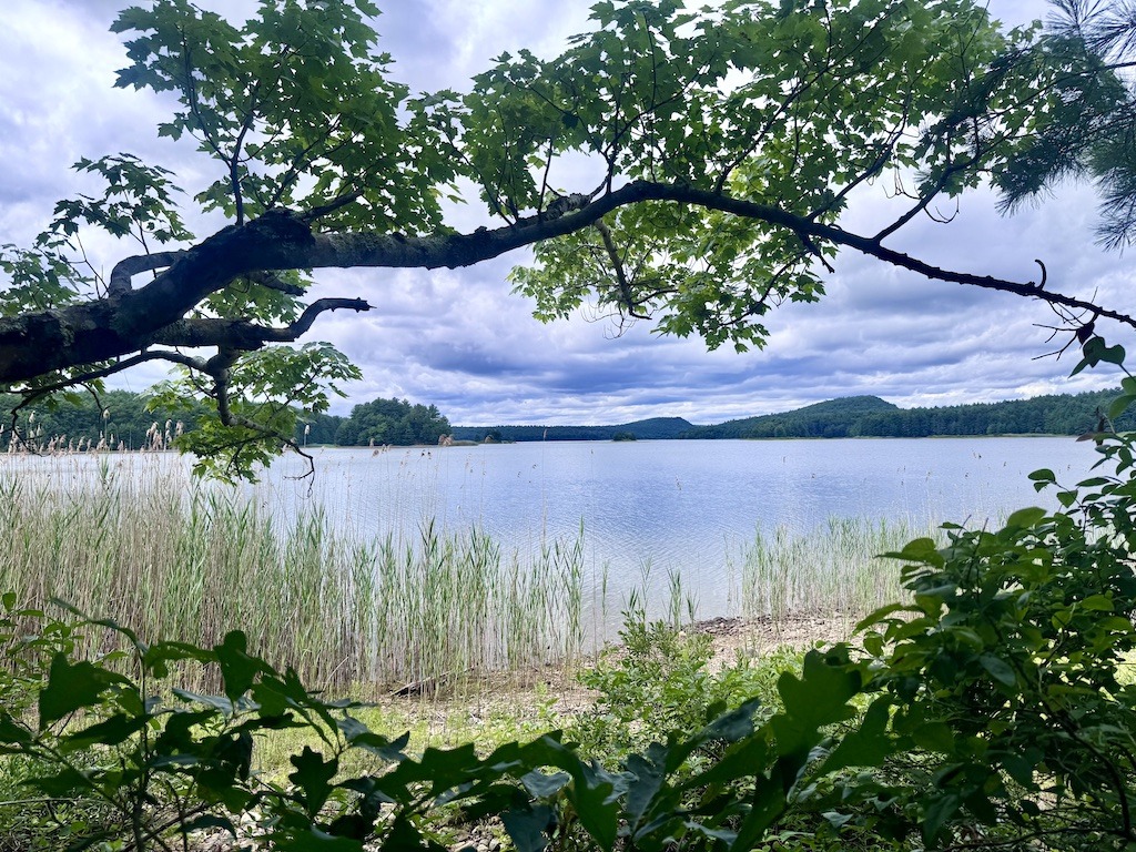
Gate 16 probably offers the quickest way to hike down and see the reservoir’s water. Walk 3/4 of a mile along a road lined with stone walls to reach the shoreline. Anglers often use the beach for shore fishing, and an outhouse sits nearby for convenience.
Gurgling streams flow under the trail, draining the watershed into the vast reservoir. Enjoy a pleasant walk as you admire the ferns and hemlocks before the forest opens up to reveal the water. Across the channel lies the remote Prescott Peninsula, where no one may visit. Behold a true wilderness where moose, bears, bobcats, and beavers roam freely.
You’ll find Gate 16 across from the road to Shutesbury off Route 202. After you cross a stream, turn right onto the wide road. Though several side trails tempt you to explore, stay on the gravel road to reach the shore.
The 1.5 out-and-back hike is a quick overview of the Quabbin watershed if you are looking for an easy walk.
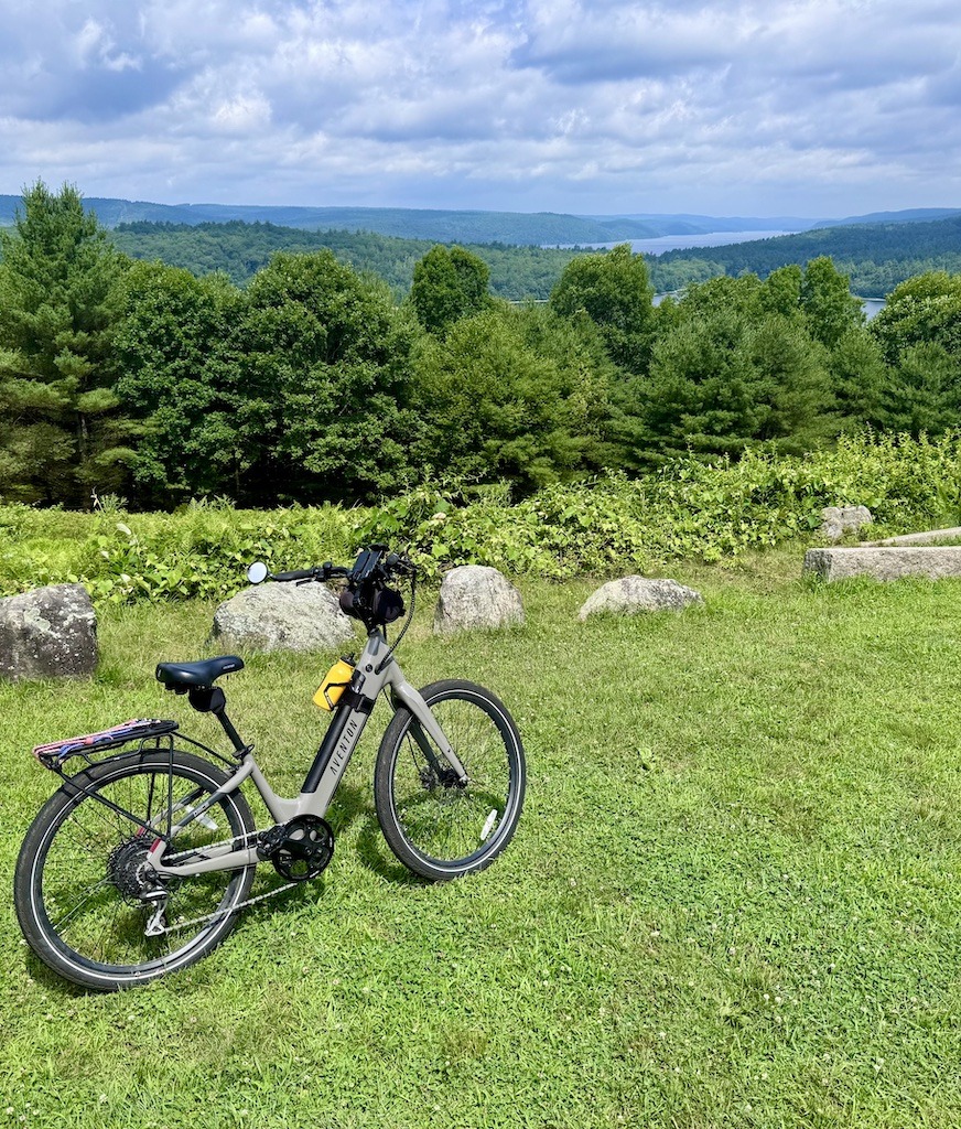
Biking Outdoor Adventures in the Quabbin Reservoir
Biking to Dana Common
A bike trip to Dana Common takes you through the history of displacement caused by the development of the Quabbin Reservoir. It is my favorite route in the Quabbin due to its diverse beauty and fascinating history.
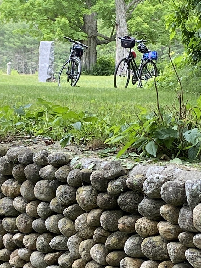
Dana is the best-preserved village site of the four towns torn down when the Swift River was flooded. As you roam around the common of the former village, imagine huge, whitewashed, clapboard houses surrounding you. Dana was once a bustling community with stores, hotels, churches, a school, a post office, and a town hall. All the buildings were sold for a pittance and torn down. The cellar holes left behind tell a story of village life in the 1930s before it disappeared. The stone walls made of round rocks salvaged from the stream is the most striking.

Dana Common is accessed from Gate 40 on the east side of the Quabbin. It is the only place on the east side to ride a bike legally. The bike ride is about 2 miles to the common. It’s mostly downhill on broken pavement. Along the way are a few cellar holes of former residences. Look carefully for mowed paths to the sites.
Bike trails around Dana Common
Several bike trails start from the common and reach the water. The most northern trail follows an old road up and over Skinner Hill to Gray’s Landing. The road is a wee bit steep, and the view at the end is spectacular, so do enjoy this 1.9-mile spur to the reservoir.
The middle trail from Dana Common circles Pottapaug Hill. It’s one of the old roads from Dana to Greenwich. The trail surface is gravel or broken pavement.
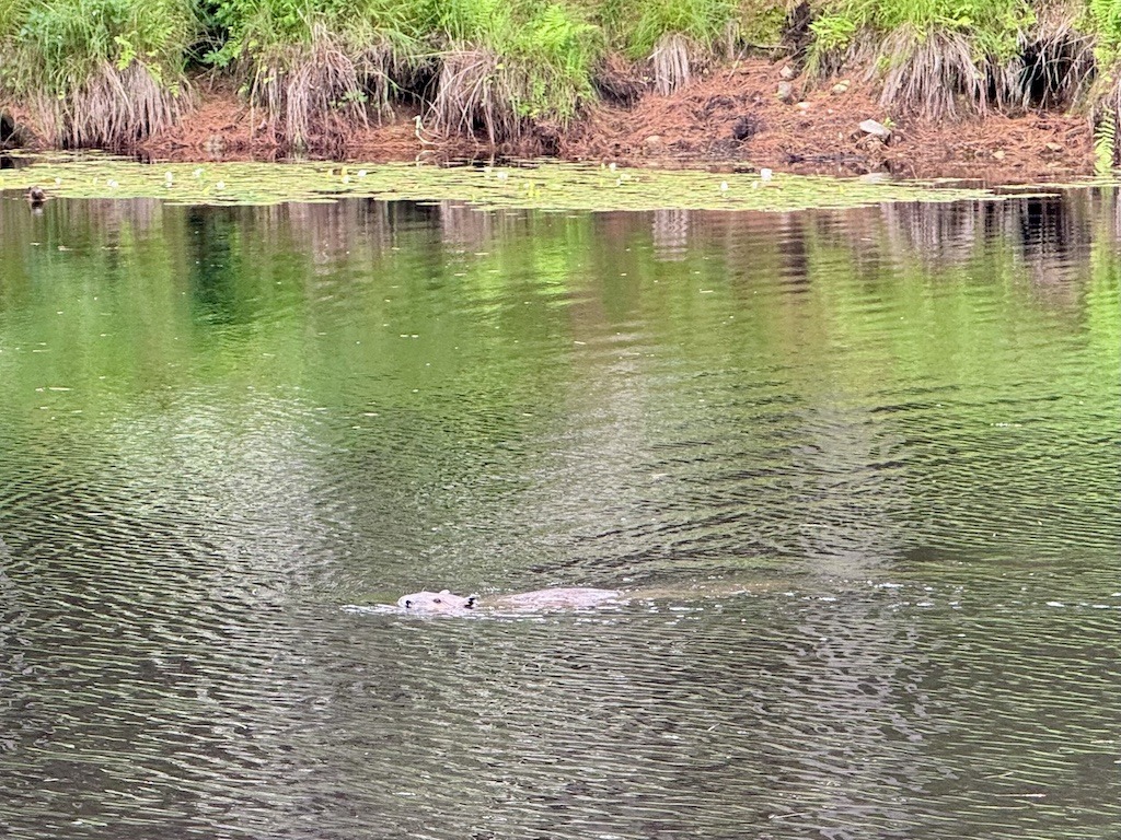
The trail crosses a bridge over the stream to Pottapaug Pond. I stopped and watched a beaver swimming back and forth in curiosity.
This bike trail continues beside the main reservoir body of water before ending at the Pottapaug Pond fishing access. From here you can backtrack to Dana Common and out at Gate 40. However, if you want to complete a loop trip, continue out Gate 43 and then ride Greenwich Road into the picturesque town of Hardwick, and then north on Route 32A until you reach Gate 40. The whole loop will be around 20 miles.
Biking in North Quabbin
The northern end of the Quabbin Reservoir features old village roads that are open to cycling. The biking roads wind around high points in the Quabbin, including Rattlesnake Hill, Harris Hill, and Fairview Hill. The roads also bring bikers down to the water, offering breathtaking views across the reservoir. The biking roads range from hilly to moderately flat. The road surfaces are either old asphalt or crushed gravel. They are a little bumpy in spots, but overall, they’re fine if you don’t ride a road bike.

Entry to the bike trails is at Gates 29, 31, and 33. There is ample parking at these gates. Quabbin rules generally prohibit biking at most gates. Therefore, to determine where biking is allowed, use the North Quabbin Reservoir Bicycle Access map .
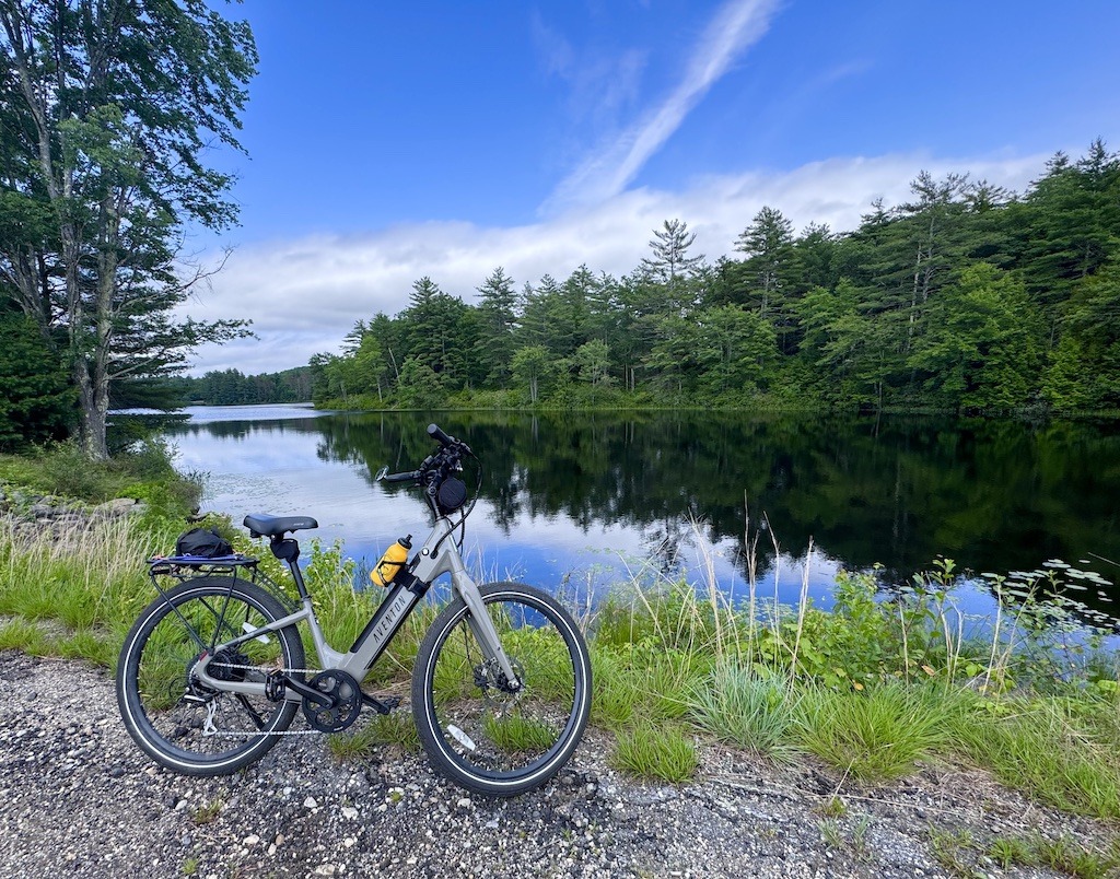
We started at Gate 29 on Route 202 near New Salem. We rode a 9-mile loop ride south to Regulating Dam Road past the fishing access and boat launch at Gate 31. Then we biked up Hager Road and turned left to leave the reservoir via Gate 33. The ride back to Gate 29 on Routes 122 and 202 completed the loop.
We were on e-bikes, so the hills didn’t bother us. In any event, the hills are manageable for most riders. You can also extend the bike trip along the east bank of the reservoir or the many country roads abutting the Quabbin to the north.
Highlights of biking in this area are the frequent vistas of the water, the old stone fences, and a unique dam regulating the ponds.

Related post -> 18 Best Bike Trails in the United States
Biking the Quabbin Reservoir Park Loop
Biking the loop around the Ouabbin Park lets you see the infrastructure that holds back the water and distributes it to points east of the reservoir. Additionally, you will enjoy the views of the water from overlooks along the route. Quabbin Park is more manicured than the more remote sections. However, it’s a beautiful ride steeped in history.
This 10-mile loop follows silky-smooth asphalt the whole way. No worries about banging up your road bike. To start the ride, park at the visitor center off the main entrance. The ride starts over Windsor Dam. The steep grass slope of the back of the dam invites big and little kids to roll down it. I have, and I recommend it.

Cycling route around Quabbin Park
The cycling journey continues past the dam spillway and up to a traffic rotary. Here, take a right to visit the Quabbin Tower. The panorama visible from the tower Hill includes the mountains of the Holyoke Range. The park has closed the tower for repairs, but the view is still lovely.
Related post -> Best Hikes in the Holyoke Range

Backtrack to continue the loop and visit the Enfield lookout. A sobering photo exhibit shows the site of the former town of Enfield now completely underwater.
As you continue your trip, you’ll see a variety of stone walls. Farmers built taller walls with large rocks to fence in pastured sheep. They stacked the lower walls with smaller stones when they cleared their fields for planting crops.
After Brown’s Field, take a left to see Goodnough Dike. While not as massive as Winsor Dam, Goodnough Dike helps out with impounding the massive amounts of water in the Quabbin.
After backtracking, the ride route exits Quabbin Park at the East Gate. You’ll need to ride along busy Route 9 to complete the loop. If this section is not as enjoyable, reenter the park at the Middle Gate and ride back over Windsor Dam to the visitor center parking.
Related post -> Best Bike Trails in Western Massachusetts
Logistics of Outdoor Adventures of the Quabbin Reservoir
Parking
The gates surrounding the Quabbin Reservoir all have parking places. You just can’t park in front of the gate itself.
Biking gear
Comfortable and functional biking gear will make your rides on these Quabbin bike roads more enjoyable. Please take a look at the gear I use on biking trips.
Bike Apparel
- Bike gloves – Cushioning your hands from bike vibrations makes for a more comfortable ride. Look for gloves with gel cushions and leather palms for good grip.
- Bike shorts – Padded bike shorts might be my favorite bike gear item. They prevent chafing and cushion your tush enough to enjoy a nice long ride. Look for high-quality chamois fabric. Light-reflection elements are great for safety.
- Bike helmet – Bike helmets don’t last forever. For safety, replace your helmet every five years. So if you still have your 20-year-old brain bucket, it’s time to get a new one. A safe ride depends on an updated helmet. Look for a well-vented helmet to keep you cool.
Bike Gear
- Handlebar bag– Tuck a snack, a map, your phone, and other go-to items in your handlebar bag for instant access. I like a handlebar bag with a transparent sleeve for a smartphone or map. And a strap that turns it into a smart-looking shoulder bag for exploring off the bike is key.
- Cycling computer – It’s fun to know how fast you are going and how long your ride is. A simple bike computer will tell you this and more. There are also computers with a GPS and other bells and whistles. However, you will pay a lot more for them. They are great for elite rides but may be overkill for a bike path.
- Bike lights – There is nothing like a sunset bike ride on a bike trail. However, after the sun goes down, you’ll need lights to find your way back. I use quick-release lights that I only put on if I’m going to travel at night. Rechargeable lights make sense too.
- Bike Tools – A bike multi-tool slipped into your handlebar bag saves headaches out on the trail. Many small bike repairs or adjustments are a breeze with this multi-tool. You will be surprised how many bike problems you can fix on the trail with the right tools.
- Bike Pump – It always seems that someone in a biking group needs to blow up a tire. Come to the rescue with this super lightweight pump that attaches easily to your bike.
- Water bottle – An insulated bike water bottle provides refreshing chilled liquid throughout the ride. I put iced tea and ice cubes in mine for a frosty drink on a hot day. It really keeps it cold.
Wrap Up of Outdoor Adventures of the Quabbin Reservoir
The countless outdoor adventures of the Quabbin will take you to breathtaking landscapes. Everywhere you will find evidence of the unique history of the Quabbin Reservoir, where four towns were displaced to provide water for the thirsty cities of eastern Massachusetts. There are prohibitive rules in place to preserve the quality of the water, and they are strictly enforced. Make sure you do your outdoor adventures in the Quabbin in the right places. Each Quabbin gate has a sign telling what outdoor activities are allowed.
Unfortunately, dogs and paddle boats aren’t allowed in the Quabbin Reservation proper. Therefore, might to interested in other Western Mass hikes or places to paddle.
Related post-> The Most Amazing Viewpoints in Western Massachusetts
Whether you choose to hike to hidden waterfalls, explore abandoned village sites by bike, or simply sit and take in the vast, quiet shores, the Quabbin Reservoir offers outdoor adventures that feel timeless. The mix of natural beauty and haunting history makes every trail and old road feel like a step back into a forgotten New England wilderness.
Because the Quabbin remains so protected, these adventures come with a sense of solitude that’s hard to find elsewhere in the Northeast. You may find yourself listening to the wind through the pines or catching a glimpse of wildlife that thrives in this accidental wilderness. It’s a place that rewards slow exploration and respect for the land and its past.
Ultimately, the Quabbin Reservoir is more than a source of water; it’s a hidden gem for anyone who loves nature, history, and the quiet thrill of discovering a place where the wild has reclaimed what people once called home.
Pin it!


5 Comments
Traveling Cats · July 17, 2025 at 9:58 am
I’m feeling relaxed just by looking at photos of this place. Quabbin Reservoir looks like a must.
Samantha · July 17, 2025 at 10:19 am
This is such a comprehensive guide! The Gate 11 water view looks like such a great little spot 🙂
Sonia · July 17, 2025 at 1:53 pm
Though we visited years ago when we were in Worcester, I never think of heading out this way when we’re visiting Boston, but we should in the future.
Casey · July 17, 2025 at 5:18 pm
This looks like such a great spring, summer, or early fall adventure! This is a great in-depth guide. I am adding this to my list next time I am near the area! Great resource!
Josy A · July 25, 2025 at 3:16 pm
What an incredible area! It’s pretty cool that this accidental wilderness has overtaken the historical villages. I would have been SO excited to see the beaver swimming through! 😀