I’ve roamed the Holyoke Range in Western Massachusetts for over 40 years. In that time I’ve found some of the best hikes in the Holyoke Range to share with you.
They say that every trail has a story. Most of the trails I share in this post on be found on AllTrails. By all means, use this great hiking resource to glean more information about the trails listed. However, I want to also give you my stories embedded in these best hikes in the Holyoke Range.
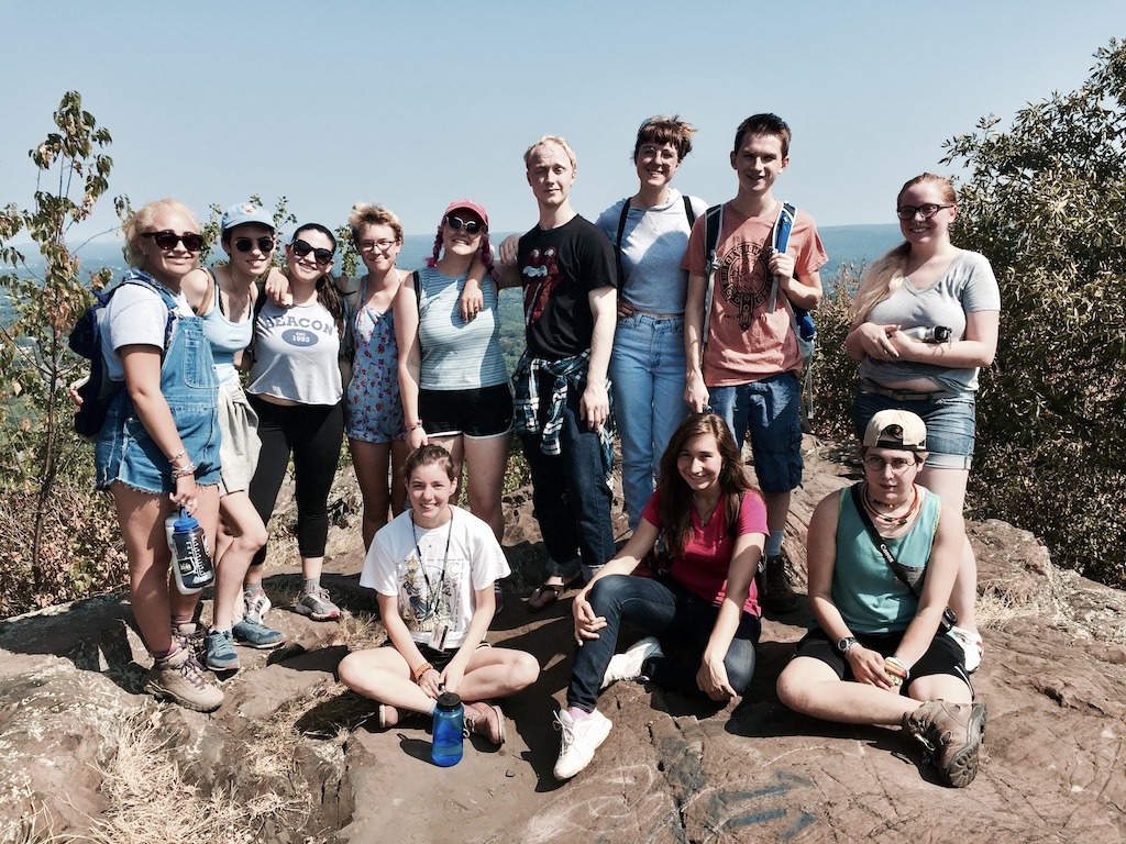
I taught outdoor leadership, experiential education, and wilderness studies for 36 years at Hampshire College which is at the base of the Holyoke Range. Therefore, the trails were part of my outdoor laboratory to take students out on adventures weekly. Between my own personal excursions and class trips, I spent a lot of time exploring this incredible area.
Posts may contain links to products and services I love. I may make a small commission from them, at no extra cost to you. Thank you for supporting my blog. Visit the privacy policy for more information.
What is the Holyoke Range?
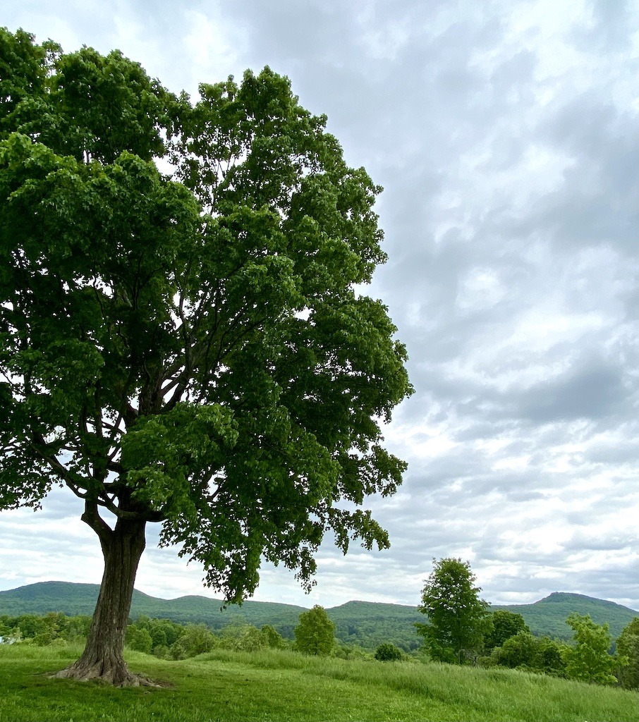
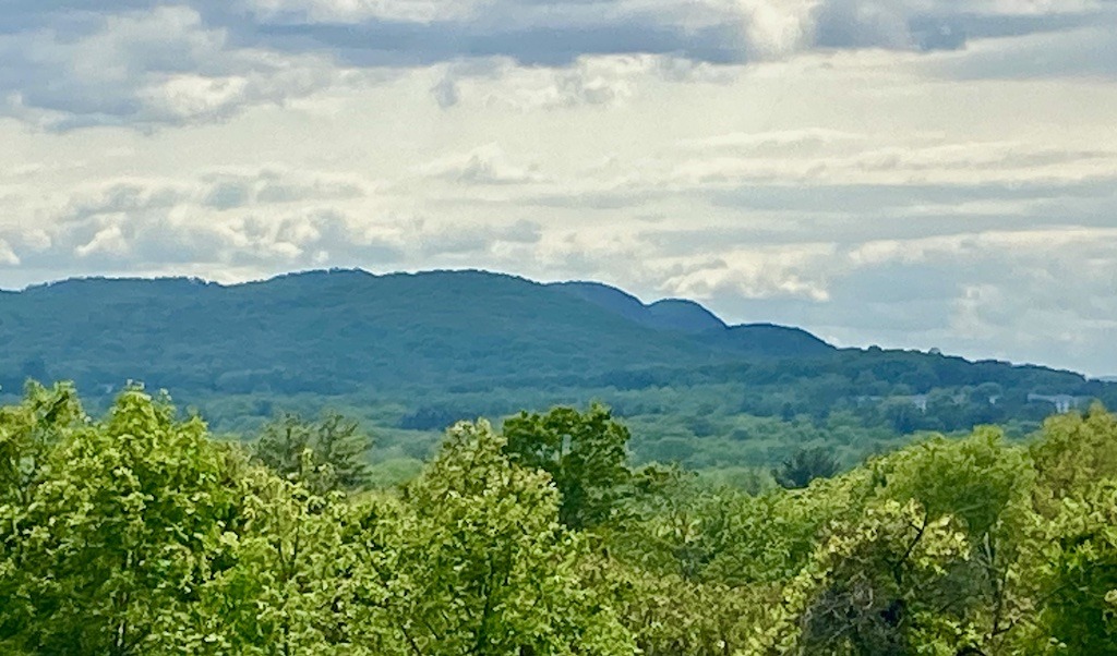
The Holyoke Range in Western Massachusetts may not be some of the tallest mountains you’ll see or even the most remote. However, the best hiking trails can be found there.
I once told a group of outdoor students that we were going to climb a mountain in the Holyoke Range. A student who grew up in Colorado hiking in the Rockies looked at me like I was crazy. Those aren’t mountains, she said. While she may have had a point, the mountains of the Holyoke Range do provide some of the best hiking in western Massachusetts. In fact, eons ago, the Holyoke Range peaks were taller than the Rockies. They were formed as much higher volcanoes and eventually eroded to the present height. You can still see volcanic rock near the trails. There are dinosaur prints nearby at the base of the range. The Holyoke Range is one of the few mountain ranges in the US that runs east-west. Why this fact is important, I don’t know, but I always remember it because most mountain ranges run north-south.
Holyoke Range history
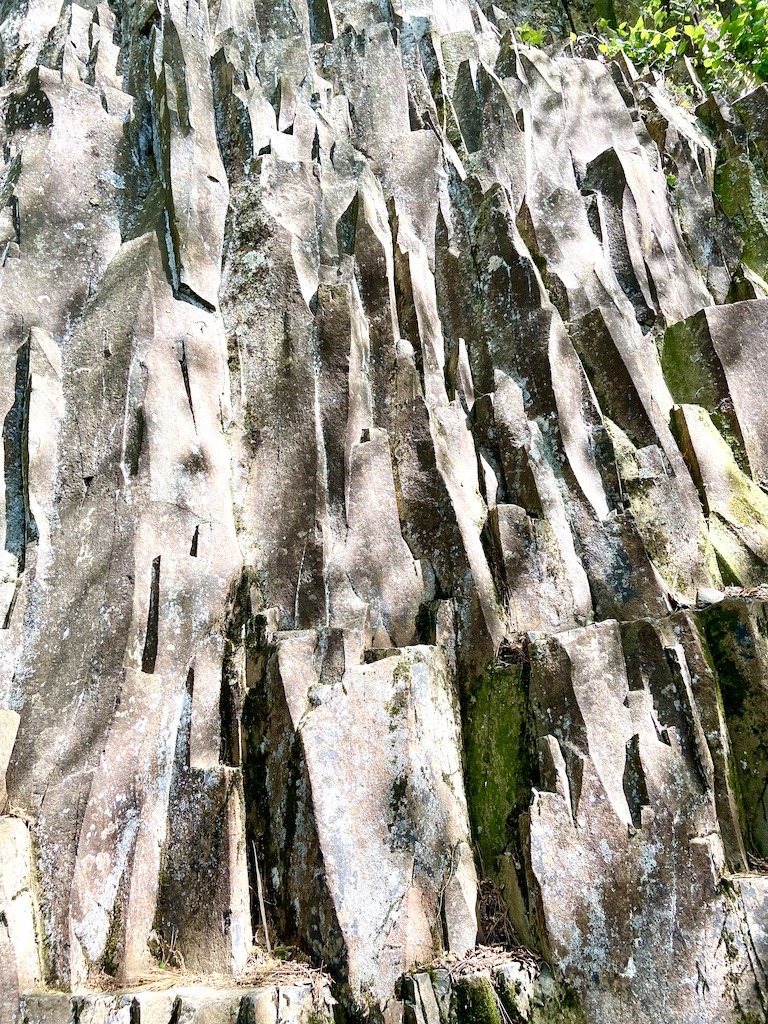
The original ridgeline of the Holyoke Range included the mountains across the Connecticut River which now include Mounts Tom and Nonotuck. They are all part of the Metacomet Ridge which started forming in the Triassic Period with massive volcanic lava flows bubbling up in the rift valley. You can see the basalt or traprock layers of the lava flow in many places in the Holyoke Range. The basalt lava hardened into octagonal and pentagonal columns, giving a distinctive column shape to the rock.
The mountains and fields of the Holyoke Range are the ancestral home of the Nonotuck people. The tribe’s name comes from the Algonquian word meaning “in the midst of the river”, referring to all the land around the Connecticut River (Kwenitegok in Abenaki).
You can learn more about national trail systems on ancestral Indigenous territories by using the Native Lands, National Trails map.
Best Easy Hikes in the Holyoke Range
Plum Brook Pond Loop
The Plum Brook Pond Loop is near the Sweet Alice trailhead on Bay Road in Amherst. From the Sweet Alice parking lot follow a trail along the road and up the Kestrel Trust property driveway until you reach the marked trailhead.
The wide flat path is blazed sky blue and circles the lake. This is the absolute best place to do a hike in the Holyoke Range in October as it’s the height of the fall colors. The reds and yellows reflecting in the pond and the magnificent scope of colors on Mount Norwottuck behind the pond set your heart to flutter. This is sigh-worthy stuff.
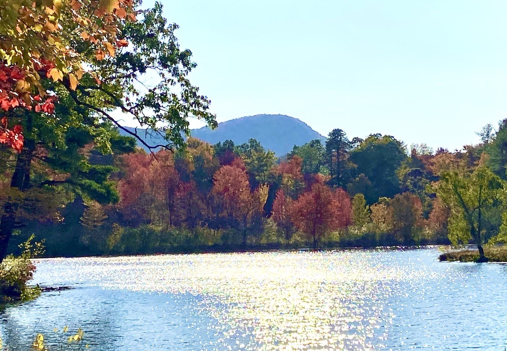
You will see a lot of beaver activity around the pond, including dams, and lodges for the very active beaver colony here. The pond has a pretty little gazebo to sit and reflect. There’s an island covered with birch trees in the center of the pond. In the fall, the colors on the island are splendid.
At one end of the pond is the Kestrel Trust office. The Kestrel Land Trust is a conservation organization that protects land in the Connecticut River Valley and surrounds. Many Kestral Trust properties have trail systems for exploring. I’ve been a land steward for the Trust for some time.
Mount Pollux
The easiest trail to get a view of the mountains of the Connecticut Valley is the one up Mount Pollux. In 10 minutes or less, you are on the top. Mount Pollux with its neighboring twin Mount Castor are the foothills of the Holyoke Range. Find Mount Pollux Conservation Area off Southeast Streat in Amherst.
I used to do my map and compass navigation class for my Outdoor Leadership course on top of Mount Pollux. The students would put on blindfolds and I’d drive them to the trailhead at Mount Pollux. We would do a group trust-building blindfold hike up the hill. They took their blindfolds off at the top, and I spread out topographical maps for them. By using their map and compass skills, they needed to find where they were on the map. Working in dyads they would triangulate off the surrounding mountains to find where they stood. Once they discovered they were on Mount Pollux, they took a bearing on Hampshire College and then followed the bearing while hiking back to campus. It was experiential education at its best.
Batchelor Street Trails
If you want to have many trail choices in a concentrated area, make sure to check out the Batchelor Street trails on the south side of the Holyoke Range. You can find this extensive trail network by turning left on Amherst Street just south of the Notch Visitor Center and then another left on Batchelor Street.
The area is a mecca for mountain bikers in Western Mass, however, the trails are great for hiking as well. Just don’t be surprised to see mountain bikers toiling up and screaming down the hill as this area has some of the best bike trails in Western Massachusetts.
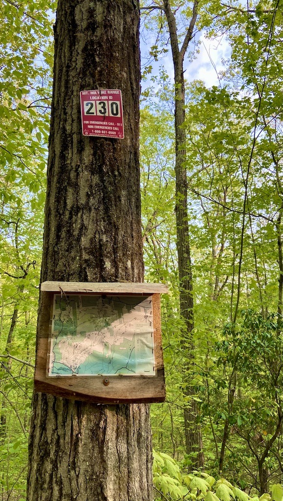
Location ID System
Mont Holyoke State Park uses a location identification system to help you pinpoint your exact location. Red signs with numbers are posted at some trail junctions to show you where you are on the map. If you get lost, you can call the number on the sign to let people know where you are. If you have an emergency, call 911 immediately. The numbers on the signs correspond to the numbers on the trail map. Batchelor Street trails are confusing enough to make carrying a trail map a good idea. Fortunately, there is a map box usually stocked at the trailhead kiosk.
Recommended Batchelor Street trail hikes
Lower Access to Upper Access trail loop
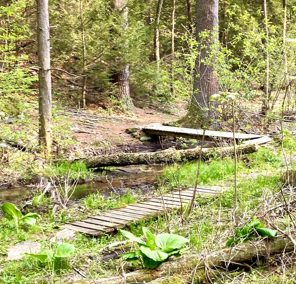
Start out on the Main Access trail to the Lower Access trail, it’s a wide easy trail to stroll along. Soon you will be walking alongside the quintessential New England rocky brook. Then you will find a large beaver pond, which in the heat of the summer is a wonderful place to take a dip. At the intersection with the Pond Trail stay right on the Lower Access trail over a series of bridges through the marsh. There is watercress in the stream, which indicates that the water is very pure.
Turn left after the bridge to stay on the blue-blazed Lower Access Trail. Soon trail marker 231 will be on your right. For a shorter hike, snake down the Serpentine Trail back to the trailhead on Batchelor Street.
If you continue on the Lower Acess trail, look for the 233 location ID sign. Go right on that trail and end on the yellow-blazed Upper Access trail. Descend Upper Access amid the majestic hemlock forest with iconic New England stone walls.
Roller Coaster loop
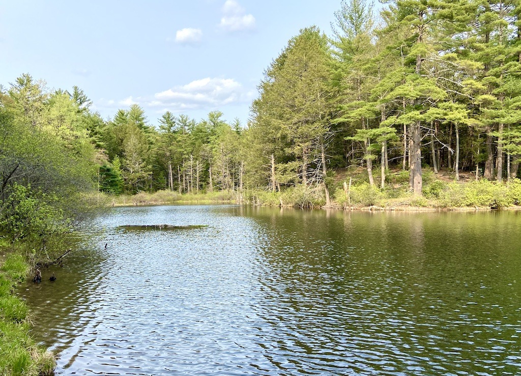
The 3-mile Roller Coaster loop is classified as moderate due to its elevation gain. It’s a mountain biking favorite but also a pretty nice hike. From the Main Access trail, take your first left onto an unsigned trail. You will climb through the forest over the height of land until it joins into the Pond Trail. Go right and follow the Pond Trail until it joins the Lower Access Trail to return to the parking lot. You can enjoy the trailside beaver pond with a dip or a contemplative rest.
All in all, the maze of Batchelor Street trails provides some of the best hikes in the Holyoke Range as well as awesome mountain biking.
Best Wheelchair Accessible Hikes in the Holyoke Range
Bray Lake Accessible Trail
This half-mile wheelchair-accessible trail is located in the Mount Tom State Reservation in Easthampton. The park is located across the Connecticut River from Holyoke Range State Park. The trail follows through the woods on the lakeshore. There are two wheelchair-accessible fishing piers on the lake.
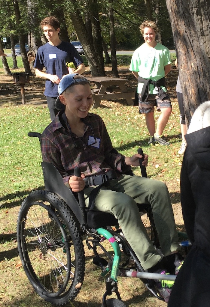
I often took my students to Lake Bray to help with accessible outdoor programming through All Out Adventures and the Universal Access Program. The programs provide outdoor activities for people with all abilities. Massachusetts has been at the forefront of states in providing outdoor recreation and accessible natural areas for people with disabilities.
Lake Bray not only is the site of accessible hiking, but in the winter the lake is used for sit skating, adaptive ice hockey, and kicksledding. My outdoor leadership class students volunteered with these programs and learned about how to make the outdoors open to all.
Mount Tom North Trailhead Park
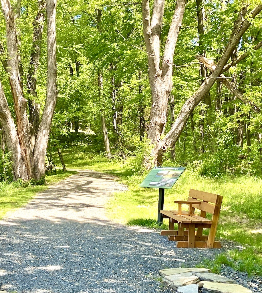
This accessible trail wanders on the north side of Nonotuck Peak from the trailhead at 96 East Street in Easthampton. Wheelchair access is maintained by moderating the incline of the crushed gravel path. There are frequent rest places along the way after gradual climbs. Each rest stop has a wooden bench and a neat gravel platform for wheelchairs.
The trail wanders through forests and fields. The openness of the forest gives it a spacious feeling. The best part of the trail is at the top with views of the Oxbow and the hill towns to the west. There are accessible picnic tables on top. Few accessible trails offer a high-point experience with views, therefore this one is a special gem.
You can continue on the Kestrel Loop Trail blazed in blue or the New England Trail (NET) indicated by white blazes, however, these trails are not accessible.
The Eyrie House ruins
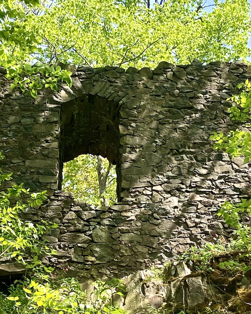
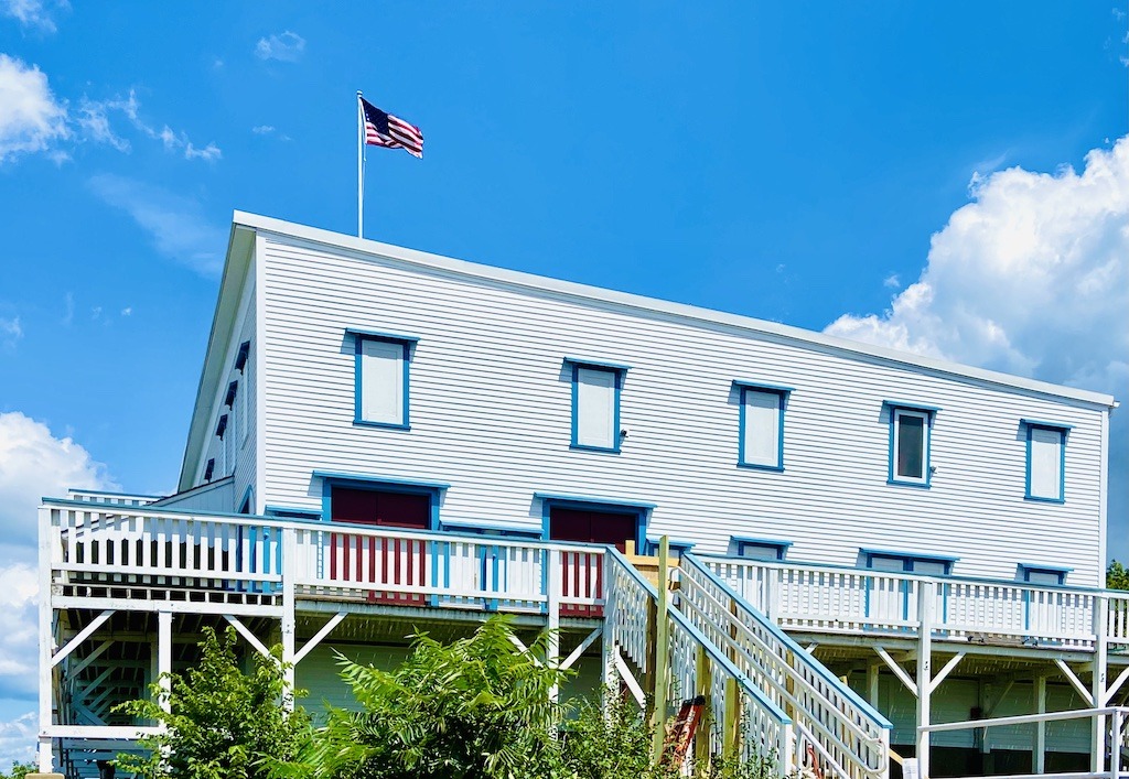
The ruins of a 19th-century summit house are an excellent hike from the Mount Tom North Trailhead. The Eyrie House was opened in 1861 as a popular mountaintop retreat for families in search of leisure. It had a panoramic viewing area, a picnic grove, a croquet court, and a pavilion for parties in its heyday. A new stone hotel was under construction when the entire property burned to the ground in 1901. Today, an interpretive hike winds around the ruins giving a glimpse of the early history of this magnificent site.
The hike up to the Eyrie house ruins atop Mt. Nonotuck is an easy-to-moderate hike with incredible views along the way. The 2.4 out-and-back hike follows the white-blazed New England trail.
Best Moderate Hikes in the Holyoke Range
Bare Mountain
Easily, Bare is my favorite mountain in the Holyoke Range and the one I’ve climbed the most. It’s so close to Hampshire College that I’d scale the 1.1-mile out-and-back trail often. When I was training to climb Kilimanjaro, the highest peak in Africa, I’d take my lunch break to climb Bare Mountain. Twice every day. It worked because I did summit Kilimanjaro.
It’s also the peak I brought students up the most. Every year I would take new students up Bare as part of orientation activities. I playfully told the Hampshire students that they couldn’t graduate until they climbed a peak in the Holyoke Range. They were relieved to know they had checked off their first graduation requirement.
Bare Mountain hike description
The hike starts on the white-blazed New England Trail across the street from the Notch Visitor Center on Route 116. It climbs steadily to an overlook of Norwottuck and the old Round Mountain quarry. Fallen traprock is strewn over the trail causing a pleasant tinkling sound as you walk over it.
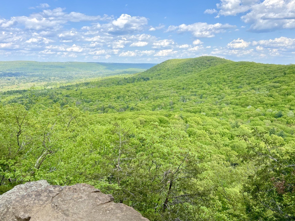
The trail continues until you find a small rock wall to scramble up. There are plenty of holds so it’s not difficult. Soon you will arrive at the basalt rock of the summit. On a clear day, Bare Mountain has views of four states. On one side of the mountain, you can see the ski resorts of southern Vermont. If you look carefully, you will see Mount Monadnock in New Hampshire on the horizon. You will also see a bright round building perched in the hills. This is the Peace Pagoda, one of the amazing spiritual retreat places in Western Mass.
Hike over to the back side of the mountain and you’ll see the city of Springfield in the near distance. If you search just beyond, you can see the faint skyscrapers of Hartford, Connecticut on the horizon.
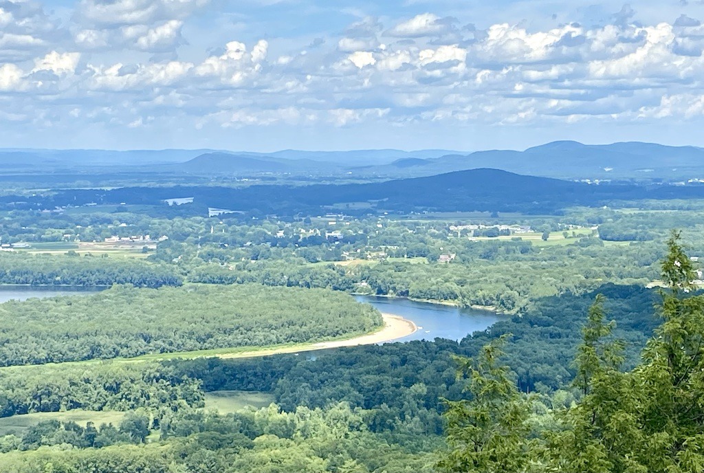
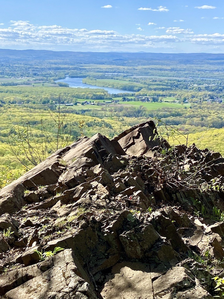
Mount Holyoke via the Devil’s Football
Hiking up Mount Holyoke was a favorite of my outdoor students. I would lead the hike at the beginning of the semester so folks could see the expanse of the Connecticut River Valley that was their home during their years at college. That’s because the view atop Mt. Holyoke is awe-inspiring–one of the best viewpoints in Western Mass.
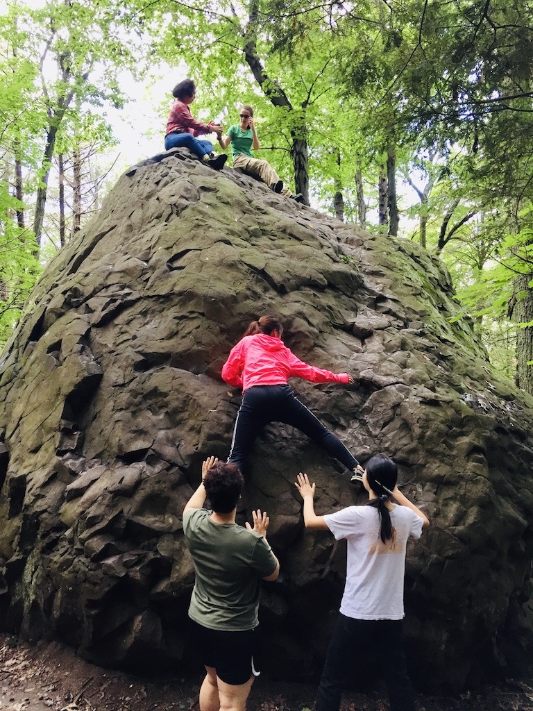
However, more than the view, I think they loved the Devil’s Football. This house-sized hunk of basalt was deposited by the last glacier on the side of the mountain. It turned out to be a fun boulder climb that was both challenging and doable for most. Seeing them all clumped on the top of the boulder after encouraging everyone to climb up was a hoot. A perfect group-building activity.
The Halfway House and the Summit House
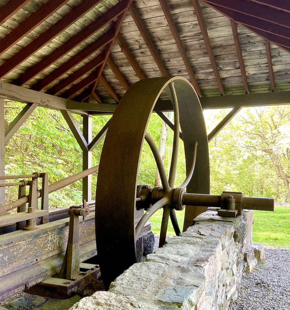
The way up Mount Holyoke on this route starts at the Skinner State Park parking lot on Old Mountain Road. The yellow-blazed Two Forest trail starts here and leads to the Devil’s Football. After messing around on the Devil’s Football, take the blue-blazed trail up the road to the Halfway House area. The Halfway House was the residence of the summit house hotel owners in the mid to late 1800s. They also built an incline railway that took hotel guests up the steep part of the mountain right into the hotel at the summit. Remnants of the incline railway’s steam engine remain at the site.
Continue on the Halfway Trail to its intersection with the white-blazed M & M trail to the summit. If you are lucky, the Prospect House (Summit House) will be open and you can learn some of the interesting history of one of the last remaining summit houses in New England. Stories about famous guests of the hotel abound. As a matter of fact, the Swedish opera star Jenny Lind and Abraham Lincoln were guests at the Summit House.
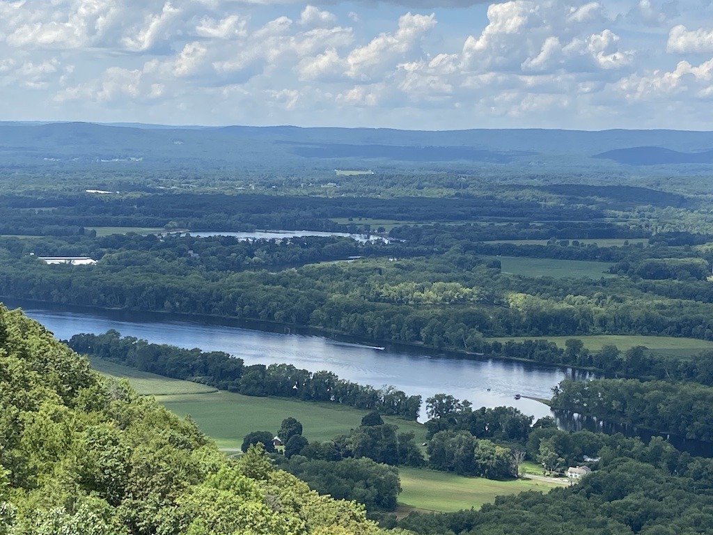
Even if the Summit House is closed, the wide verandas provide an incredible 360° panorama of the surrounding landscape. Interpretive signs on the porch point out all the mountains on the horizon.
The story of Mitch’s Island
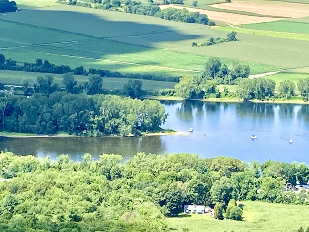
Besides the mountains in the distance, views of the Connecticut River can be seen. Look south to see the oxbow of the river that was famously depicted in a Thomas Cole painting. You can also see Mitch’s Island below you. It’s named after Mitch who ran nearby Mitch’s Marina for years.
As testimony to how a great river is constantly changing, this island wasn’t there 40 years ago. When I first started canoeing this section of the Connecticut River in 1983, this area was a clear river channel. After a few years, a sandbar appeared that made a nice mid-river stopping place. Then, small sprouts of trees took hold, and the island grew as soil eroded from the upriver banks was deposited on the island. In time, the trees continued to grow into a mature forest. Now, a rare floodplain forest is a centerpiece of the island that didn’t use to exist a few decades ago.
Mount Norwottuck
Mount Norwottuck, the highest mountain in the Holyoke Range, has a 3.4-mile loop hike that brings you by the Horse Caves to the summit and back to the Notch Visitor Center on Route 116. For a shorter walk, you can do an out-and-back hike up to the summit of Norwottuck on the M & M trail.
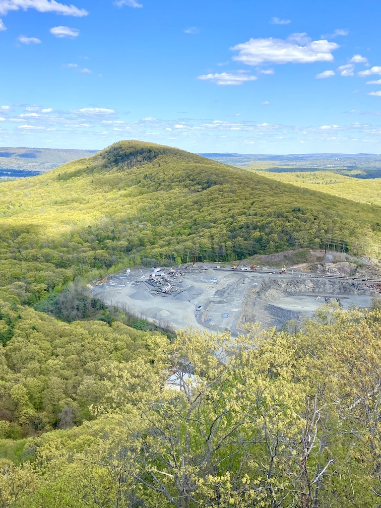
For the loop, start at the Notch Visitor Center and follow the white-blazed M&M trail into the woods. It will wind around and soon you will see a rock quarry on the right. This area used to be Round Mountain, a steep mountain squeezing the road between it and Bare Mountain. But in the late 1800s folks decided traprock made really good gravel for road construction. It’s been mined ever since and Round Mountain is no more.
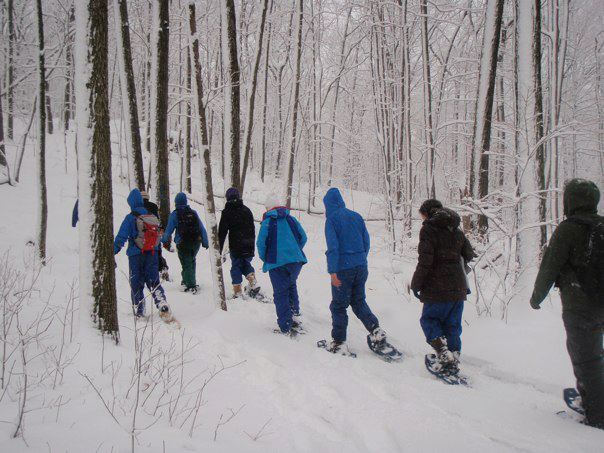
The hike up Norwottuck on the M&M trail has some viewpoints along the way and a few false summits. Just when you think you are near the top there is another small dip and climb. These steep sections made Norwottuck a perfect winter snowshoe hike for my outdoor students. When we would descend the snowy steep parts, the slippery slopes were perfect for butt bobsledding. We had a ton of fun with our snowshoed feet up in the air while sliding down on our backs like upside-down turtles.
There is a PVTA bus stop on the top of the hill by the Notch, making hiking Bare and Norwottuck more accessible to those without cars.
Long Mountain
Long Mountain is the perfect hike if you want to see fewer people on the trail. This peak is the furthest east of the Holyoke Range and gets less traffic than some of the others.
The 2.2 out-and-back hike starts at a trailhead on Harris Mountain Road. You follow the white-blazed New England Trail and the orange-blazed Robert Frost Trail. The trail is steep in places as it travels through beautiful oak, maple, and hickory forest.
You will reach a high point with a town boundary marker, saying A for Amherst and G for Granby on it. There’s a great view here, but the true summit of Long Mountain is further along. Ramble up and down a few valleys and you will reach the top of Long Mountain at 920 feet. The view to the west is of Rattlesnake Knob and Mount Norwottuck.
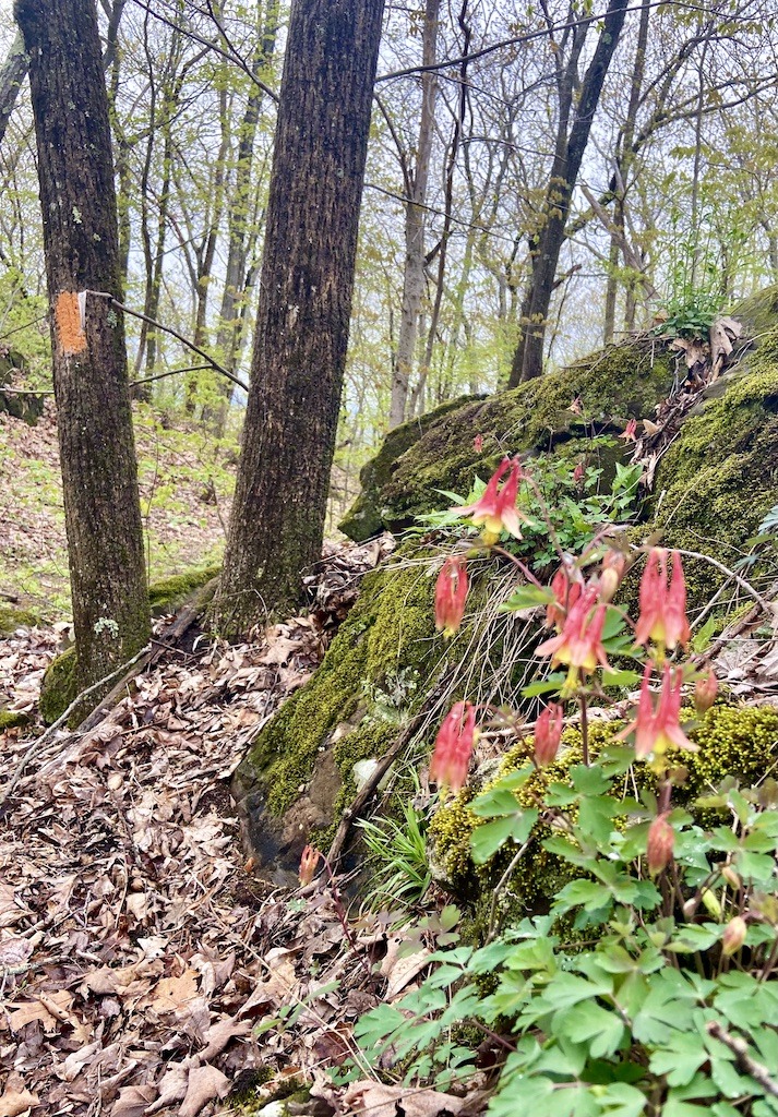
Spring is a wonderful time to hike this trail to see the views through the tree that are just leafing out and to look for columbine flowers and other spring flowers along the trail.
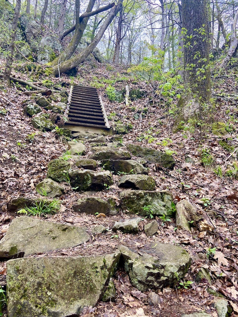
This trail is special to me as it was the trail my longtime outdoor instructor colleague, Kathy, hiked during her cancer journey. After she passed, friends and family got together and built the stone stairs that climb up the steepest part of the trail. We dedicated the trail to Kathy and it’s known locally as Kathy’s Trail.
Rattlesnake Knob
Rattlesnake Knob is the little mountain that could. This rounded bump of basalt is sandwiched between Long Mountain and Norwotuck. It’s dwarfed by its neighbors but beats them in views hands down.
Several trails ascend Rattlesnake Knob. The M&M trail goes over the top of Mt. Norwotuck and then up to Rattlesnake Knob. The path I like to hike follows the Ken Cuddeback trail. It starts at the trailhead on Bay Road just east of Middle Street. The trail gently climbs up to the fire tower on a wide, flat road. After the fire tower, continue on the blue-blazed Ken Cuddeback trail. It will be gradual for a while and then start to steepen as you approach the knob. At the top of the steep incline, turn left to stay on the blue, orange, and white blazed trails, then continue to follow the blue to the top of the hill.
Rattlesnake Knob views
Expansive views of Long Mountain and the Pelham Hills can be had from the bare basalt ledges on the west side of the knob. From the other side of the knob, the mountains you can see, from left to right, are Mount Warner, South and North Sugarloaf, and Mount Toby and the Pocumtuck Ridge, with Mount Grace the most distant. If you peer through the trees on the north side, you might be able to see Mount Monadnock in New Hampshire.
Rattlesnake Knob is my first-morning view in the spring and winter. When I retired from teaching, I built a tiny house on my property. The 8 x 12 ft. cabin was designed to emulate the best of the retreat cabins at Temenos, a nearby spiritual retreat center in Shutesbury. My tiny house serves as a writing retreat and a place of reflection for an introvert to escape the Zoom calls of life. I situated the tiny house so the window in front of my writing desk looks out from the Pelham Hills onto Rattlesnake Knob. When the leaves are off the trees, I get a fine view of the sweet little hump in the middle of the two larger mountains.
Related post -> Best Mt. Toby Outdoor Activities
Best Hard Hikes in the Holyoke Range
Seven Sisters Hike
If you look at the Holyoke Range between Bare Mountain and Mount Holyoke from the river valley, you will see a number of knobs of peaks spread across the view. The Seven Sisters is the name of the ridgeline. The name is related to the seven sister colleges, a group of historically women’s colleges located in the Northeast. Mt. Holyoke and Smith Colleges are nearby representatives. The name of the hike also refers to the seven sister stars of the constellation Pleiades which can be seen from the mountain.
I used to take my Hampshire students on a moonlight hike on part of the Seven Sisters route. We were dropped off at the base of Mt. Holyoke where we made our way to the top and then across the Seven Sisters. We would drop down the Northside trail through the maze of trails around the Hadley reservoirs and walk back to Hampshire College. I always tried to make a point of seeing the Pleiades constellation on the hike. Hiking at night under the light of the moon is certainly a great way to experience these hikes in the Holyoke Range. Under a full moon, you don’t even need a headlamp (although you should take one for safety’s sake).
Seven Sisters hike description
The whole Seven Sisters hike is a 6-mile point-to-point hike between Mt. Holyoke and Bare Mountain. You can do it in either direction. I like to do it starting at the Notch on Route 116 in Amherst. You start by climbing up Bare Mountain and then follow the white-blazed M&M trail heading west. Your next major peak is Mt. Hitchcock at 1005 feet. From there the actual Seven Sisters peaks start.
A seemingly endless succession of hiking up and down will convince you that a few extra mountains made their way into the Seven Sisters hike. These evil step-sister peaks will continue until you reach Taylor’s Notch. For a shorter hike, descend here following the yellow blazes to the Taylor’s Notch trailhead parking area on Route 47 in Hadley. To finish the official route, ascend Mt. Holyoke, check out the view, and then keep following the M&M trail to descend to the trailhead on Old Mountain Road in Hadley.
A trail running race on the Seven Sisters is held the first Saturday in May each year. You’ve been warned, it’s not a great day to hike that trail.
Holyoke Range Traverse
If you want the whole enchilada of hikes in the Holyoke Range then do the traverse from the trailhead on Old Mountain Road to the trailhead on Harris Mountain Road. This point-to-point hike covers almost 12 miles on Sections 7 and 8 of the New England Trail. Starting on the white-blazed M & M Trail on Old Mountain Road, you will soon pass the Mt. Holyoke College Outing Club cabin. I’d used this simple structure to host overnight camping with my students and girls from Girls Inc. in Holyoke. It was a practicum directed by my students to introduce Latina girls to outdoor adventures such as hiking or camping. You can rent the cabin as it’s the only place to legally camp in the Holyoke Range.
The first 6 or so miles of the hike are the same as the Seven Sisters hike. Halfway through the hike, you will descend Bare Mountain, cross Route 116, and arrive at the Notch Visitors Center. If it’s open, the building is a good place to resupply your water bottles.
The second 6 miles of the traverse goes over Norwottuck, Rattlesnake Knob, and Long Mountain before popping out on Harris Mountain road. A car or bike shuttle is necessary for the hike.
Training on the Traverse
I used to hike the traverse before I had a big hiking trip I wanted to feel prepared for. Once when I was training to climb Kilimanjaro in Africa, I hiked the traverse with my dog. She would run ahead and then come back to see me and then run ahead again. By the time we got past the Notch Visitor Center, she had realized she was doing the trail twice, which was getting tiring. The last five miles she wised up and just trotted along in front of me. I think she realized she wasn’t going to Kili so didn’t need the extra miles.
Related post -> The Best Paddling Spots in Western Massachusetts
Best Places to Stay for Hikes in the Holyoke Range
The nearby towns of Amherst and South Hadley are perfect for overnight stays to explore all of the natural areas of the Connecticut River Valley including the best hikes in the Holyoke Range. I recommend the following accommodations.
The Daniel Stebbins Bed and Breakfast in South Hadley has all the New England charm you are looking for. In fact, one of the rooms is called the Joseph Allen Skinner room named after the state park on the Holyoke Range. It’s close to the hikes on the south side of the range.
The Inn on Boltwood is located in the heart of Amherst. This popular inn has kept its historic features while creating a cozy welcoming space to relax. There is an excellent on-site restaurant or you can walk to nearby places to dine in Amherst.
Best Gear for Hikes in the Holyoke Range
Comfortable lightweight hiking shoes are sufficient for all the trails in the Holyoke Range. With all the ups and downs, hiking poles are also useful. Bring a water bottle and drink plenty of water. A small backpack can carry your water, snacks, extra layer, and insect repellent.
Wrap Up of Best Hikes in the Holyoke Range
As with all hikes, please follow the practice of Leave No Trace. Also, note that water sources are limited on these hikes so carry an adequate supply with you. Dogs on leashes are welcome on all trails. Many of the trails listed are suitable for the whole family. Finally, the hiking trails of the Holyoke Range are a year-round destination. Cross country skiing and snowshoeing in the winter and leaf peeping in the fall are amazing activities.
Related post -> Proven Winter Hiking Tips
You can download the map of the hikes in the Holyoke Range here.
While I was writing this blog post, I went back and hiked all the trails in this article. I wanted to see if things had changed since last I’d been there, but mostly I wanted to renew the memories that I have of these hikes. Once again, I was struck by the gorgeous landscapes found in the best hikes in the Holyoke Range. Therefore, please use this guide to explore the trails and make your own memories.
Pin it for later!


10 Comments
Josy A · June 13, 2023 at 1:36 pm
I love these kind of stories to help get to know a range and the Holyoke range is just lovely! I can totally imagine your dog running off ahead, and back (soooo many dogos do that!) It’s great that you can use the mountains you know well to train for exotic (and epic) trail like Mount Kilimanjaro!
p.s. I wish I could have been in your outdoor class! The snowshoeing, and the blind hike up Mount Pollux to work out your location all sounds great – Such a fun way to learn!
Claire · June 13, 2023 at 4:47 pm
That photo showing the column shape of the basalt rocks looks like a piece of abstract art! I love the Devil’s Football as well, I wouldn’t be able to resist climbing that.
I wish I had taken an orienteering class; the one you described on Mount Polluck sounds like a great hands-on way to test your mettle and prove to oneself that you really can find your way in the wilderness without a cell phone. I took a brief orienteering class at REI that was just a few hours long one time but can’t remember any of what I learned.
A Capone Connection · June 14, 2023 at 10:46 pm
These look like some really cool hiking spots. I love the trails and the rock formations. I think it would be especially cool to hike them in the fall when you can enjoy all of the fall foliage. Thanks so much for sharing!
Kim · June 15, 2023 at 2:13 am
This is my kind of hiking, although I’d pick the not-too-strenuous. I love the information you’ve given on each one and your photos make me believe I’m there. Thanks for sharing.
Lisa · June 15, 2023 at 3:15 am
These hikes all sound great, and I imagine they look quite lovely in autumn. I’d definitely pick one of the easier ones, but I’d love to do them all.
Marilyn · June 15, 2023 at 7:16 am
Such a beautiful location to do regular hiking trails. A mix of picturesque valleys, views, very unique basalt rock formations and river views that provide varing levels of fitness. Appreciate you sharing the history side of various trails. I would certainly need to start with the less strenuous option and progress to others that require more fitness.
Melanie · June 17, 2023 at 2:50 am
You hooked me from the beginning with your credentials! I love the stories about how this area has changed over time, like the birth of Mitch’s Island or the mining at Round Mountain.
Farrah · July 14, 2023 at 2:41 am
I’d so love to come here in the fall! I like the location identification system they have too. Roller Coaster loop + Seven Sisters look like they’d be fun!
Chris Fox · May 30, 2024 at 5:08 pm
Great stuff! I’ve lived near the range all my life and have done most of the hills. It’s an especially great range to hike in the fall d/t the abundant foliage opps.
I grew up on Batchelor St. in Granby and noticed one small mistake. The pond off of Batchelor St. on the trail that heads toward Norwottuck is not a beaver pond but was dug and dammed (there’s an overgrown earthen dam at the south end of the pond, where it flows into a brook). The pond was dug by a man named Aldrich (nearby Aldrich lake named for him). I believe the pond originally was used to store logs – entire area used to be logged.
Karen · June 3, 2024 at 4:53 pm
Chris, thanks for the information about the pond off Batchelor Street. I called it a beaver pond because there was beaver activity there. However, I like knowing the history of its original. I’ve paddled hundreds of times on Lake Aldrich so it’s cool to know that Mr. Aldrich dug the pond.